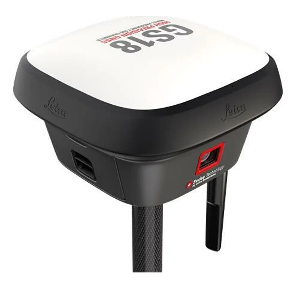
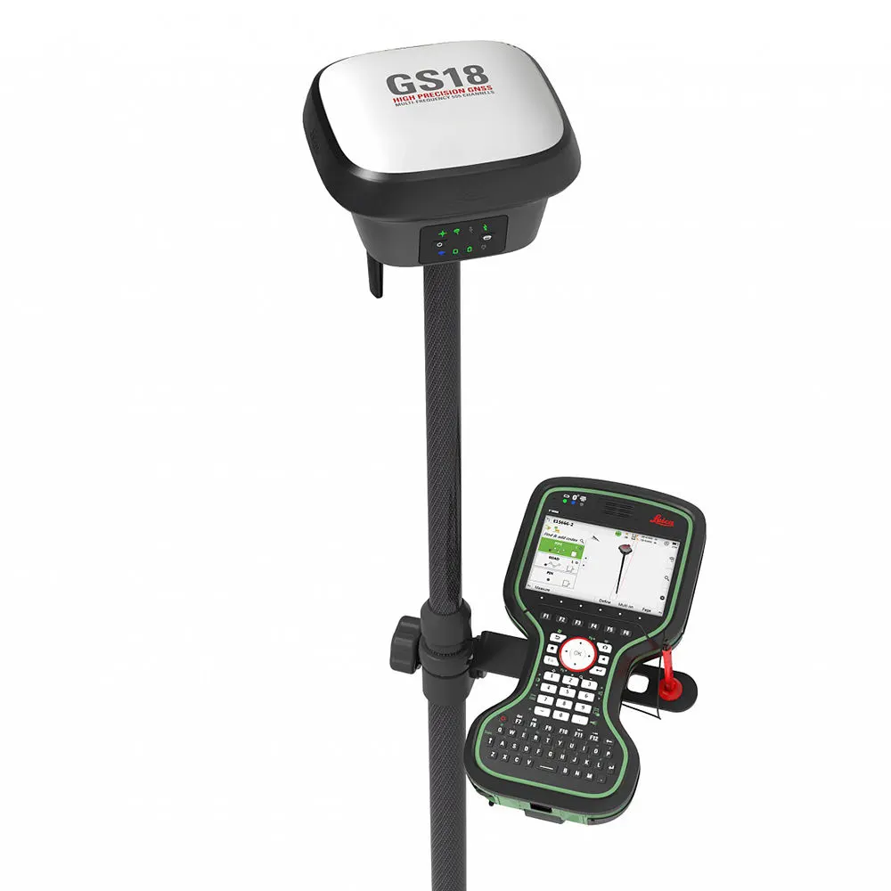
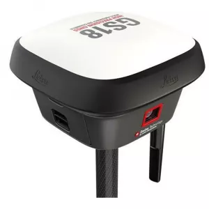
Leica GS18 GNSS RTK Rover, the GNSS smart antenna that grows with your business
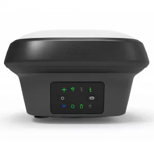
The Leica GS18 is a self-learning GNSS smart antenna. GS18 inherits all features of the Leica GS18 T except tilt compensation. However, the GS18 grows with your business: upgrade it to a tilt compensating system at any time. The GS18 is an excellent companion to a surveyor that primarily works with a network RTK such as HxGN SmartNet. Like most of the Leica Geosystems GNSS smart antennas, the GS18 works as a rover and a base.
The Leica GS18 I, a versatile, survey-grade GNSS RTK rover with Visual Positioning. Designed for surveying professionals to measure points which previously could not be measured with a GNSS rover easily and accurately. Now, you can quickly capture the site in images and measure points from them, either in the field or later in the office.
Sensor fusion from GNSS, IMU and a camera comes together to create Visual Positioning technology, resulting in a GNSS RTK rover so powerful that it enables you to measure what you see.

The Leica GS18 I has all the functionality of the Leica GS18 T: in addition to Visual Positioning, users can for example map points with either tilted or levelled pole.
TILT COMPENSATION UPGRADE: Whenever you need the efficiency and safety improvements gained from tilted measurements, upgrade your GS18 to a tilt compensating rover. Any Leica Geosystems service can do the upgrade at any time.
ENGAGING SOFTWARE: Leica Captivate field software is the perfect companion for the GS18. Everything from measuring, viewing, and sharing data is done within one software. Easy-to-use apps and precise 2D views/3D models enable you to understand, create and utilise data effectively. Captivate spans industries and project use cases with little more than a simple tap, regardless of whether you work with GNSS, total stations or both.
IMPROVED PERFORMANCE: Multipath reduction and interference mitigation options in Captivate boost GNSS signal tracking quality under harsh environments, which improves RTK availability and accuracy. Also, an interference toolkit will enable filtering to remove in- and out-of-band distortions for even more robust GNSS signal tracking.
4G LTE & EXCELLENT MEASUREMENT QUALITY: Tracking multi-frequency signals comes as a standard to all Leica Geosystems GS sensors. Combined with an excellent GNSS antenna element and a position update rate of 20 Hz, the GS18 ensures reliable measurement quality.
INTERNAL MEMORY: Users with any GS18 model have the flexibility to log raw data into an SD card or the internal memory.
ACTIVE CUSTOMER CARE: Through Active Customer Care (ACC), a global network of experienced professionals is only a click away to expertly guide you through any challenge. Eliminate delays with superior technical service, finish jobs faster and avoid costly site revisits with excellent consultancy support. Control your costs with a tailored Customer Care Package (CCP), giving you peace of mind you are covered anywhere, anytime
SEAMLESSLY SHARE DATA AMONG ALL YOUR INSTRUMENTS: Leica Infinity imports and combines data from your GNSS RTK rover, total station, level instruments and laser scanners for one final and accurate result. Processing has never been easier because all your instruments work in tandem to produce precise and actionable information.
Leica GS18 GNSS RTK Rover Technical Specifications
| GNSS TECHNOLOGY & SERVICES | ||
| Self-learning GNSS | Leica RTKplus | Adaptive on-the-fly satellite selection |
| HxGN SmartNet Global | HxGN SmartNet Pro | Network RTK and unlimited worldwide RTK bridging and PPP service |
| HxGN SmartNet+ | Network RTK and RTK bridging service | |
| HxGN SmartNet PPP | Unlimited worldwide RTK bridging and PPP service | |
| Leica SmartCheck | Continuous check of RTK solution | Reliability 99.99% |
| Signal tracking | GPS | GLONASS | L1, L2, L2C, L5 | L1, L2, L2C, L3 |
| Galileo | BeiDou | E1, E5a, E5b, AltBOC, E6 | B1I, B1C, B2I, B2a, B3I | |
| QZSS | NavIC | L1, L2C, L5, L62 | L53 | |
| SBAS | TerraStar | WAAS, EGNOS, MSAS, GAGAN | L-Band, IP | |
| RAIM | Receiver Autonomous Integrity Monitoring | Detection and elimination of faulty satellite signals for enhanced position solution and GNSS integrity |
| Number of channels | 555 (more signals, fast acquisition, high sensitivity) | |
| MEASUREMENT PERFORMANCE & ACCURACY | ||
| Time for RTK initialisation | Typically 4 s | |
| Real-time kinematic (Compliant to ISO17123-8 standard |
Single baseline Network RTK |
Hz 8 mm + 1 ppm | V 15 mm + 1 ppm Hz 8 mm + 0.5 ppm | V 15 mm + 0.5 ppm |
| RTK bridging | Up to 10 min bridging of RTK outages | Hz 2.5 cm | V 5 cm |
| PPP | Initial convergence to full accuracy typically 10 min, Re-convergence < 1 min |
Hz 2.5 cm | V 5 cm |
| Post processing | Static (phase) with long observations Static and rapid static (phase) |
Hz 3 mm + 0.1 ppm | V 3.5 mm + 0.4 ppm Hz 3 mm + 0.5 ppm | V 5 mm + 0.5 ppm |
| Code differential | DGNSS | Hz 25 cm | V 50 cm |
| COMMUNICATIONS | ||
| Communication ports | Lemo | Bluetooth® | WLAN | USB and RS232 serial | Bluetooth® v4.0 (BLE & BR/EDR), class 1.5 | 802.11 b/g/n for field control communication only |
| Communication protocols | RTK data protocols NMEA output Network RTK |
Leica, Leica 4G, CMR, CMR+, RTCM 2.2, 2.3, 3.0, 3.1, 3.2 MSM NMEA 0183 v4.00 & v4.10 and Leica proprietary VRS, FKP, iMAX, MAC (RTCM SC 104) |
| Built-in LTE modem4 | LTE frequency bands UMTS frequency bands GSM frequency bands |
20, 8, 3, 1, 7 | 13, 17, 5, 4, 2 | 19, 3, 1 8, 3, 1 | 5, 4, 2 | 6, 19, 1 900,1800 | 850,900,1800,1900 MHz |
| Built-in UHF modem5 | Receive & transmit UHF radio modem | 403 – 473 MHz, channel spacing 12.5 kHz, 20 kHz, 25 kHz, max. 1 W output power up to 28800 bps over air; 902 – 928 MHz (licence free in North America), max 1 W output power |
| GENERAL | ||
| Field controller and software | Leica Captivate software | Leica CS20 field controller, Leica CS30 & CS35 tablets |
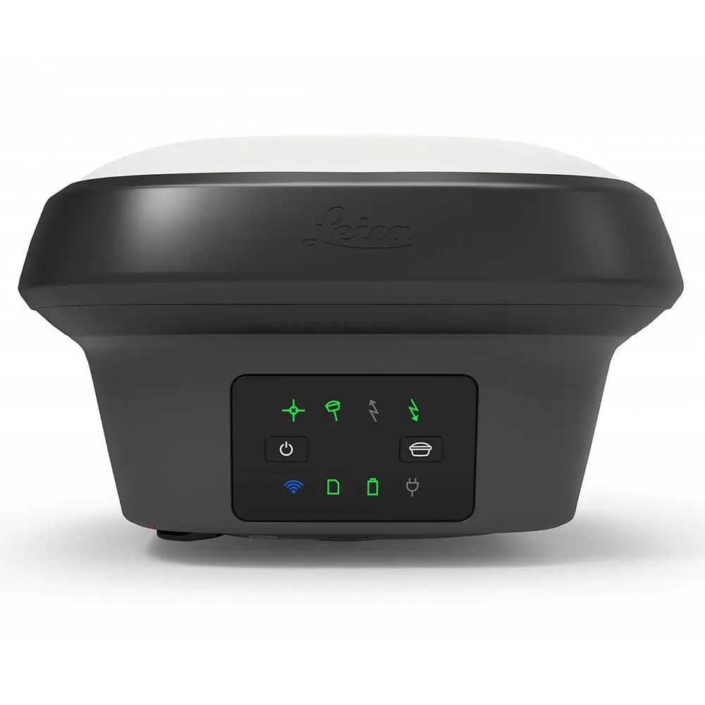
| User interface | Buttons and LEDs Web server |
On / Off and Function button, 8 status LEDs Full status information and configuration options |
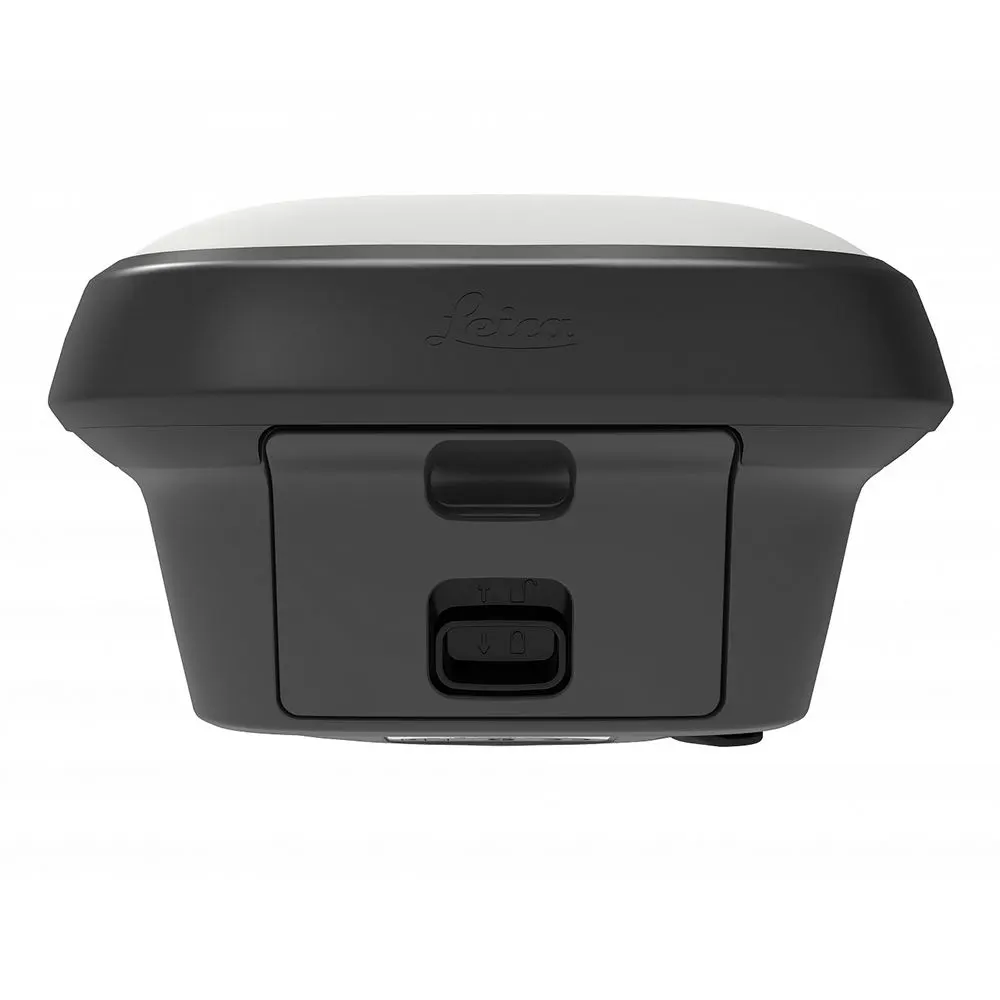
| Data recording | Storage Data type and recording rate |
Internal memory up to 4 GB, Removable SD card Leica GNSS raw data and RINEX data at up to 20 Hz |
| Power management | Internal power supply External power supply Operating time6 |
Exchangeable Li-Ion battery (2.8 Ah / 11.1 V) Nominal 12 V DC, range 10.5 - 26.4 V DC Typical time up to 8 h |
| Weight and dimensions | Weight | Dimensions | 1.20 kg / 3.50 kg standard RTK rover setup on pole | 173 mm x 173 mm x 109 mm |
| Environmental |
Temperature Vibration |
-40 to +65°C operating, -40 to +85°C storage Withstands topple over from a 2 m survey pole onto hard surfaces IP66 | IP68 (IEC60529 | MIL STD 810G CHG-1 510.6 I | MIL STD 810G CHG-1 506.6 II | MIL STD 810G CHG-1 512.6 I) Withstands strong vibration (ISO9022-36-08 | MIL STD 810G 514.6 Cat.24) 95% (ISO9022-13-06 | ISO9022-12-04 | MIL STD 810G CHG-1 507.6 II) 40 g / 15 to 23 msec (MIL STD 810G 516.6 I) |
| TILT COMPENSATION UPGRADE | ||
| Tilt compensation | Increased measurement productivity and traceabilityCalibration-free, Immune to magnetic disturbances | Calibration-free, Immune to magnetic disturbances |
| Real-time kinematic tilt compensated | Not for static control points | Additional Hz uncertainty typically less than 8 mm + 0.4 mm/° tilt down to 30° tilt |
Documentations
 >
>
 >
>
 >
>
 >
>