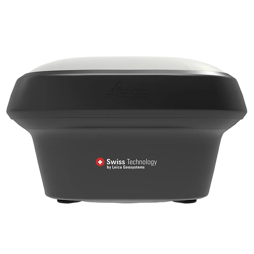
New Leica GS18 T GNSS RTK Rover, the original tilt compensating GNSS RTK rover
Leica GS18 T GNSS RTK Rover, the original tilt compensating GNSS RTK rover
You can forget the bubble when you use the Leica GS18 T. It is the original truly tilt compensating GNSS solution that is immune to magnetic disturbances and is calibration free. The sensor fusion of GNSS and Inertial Measurement Unit (IMU) creates the original true tilt compensating GNSS smart antenna. For GS18, T means tilt.
As you no longer need to watch and level the bubble, you can focus on your task at hand and save time. The GS18 T works directly out of the box without any calibration procedure and like most of the Leica Geosystems GNSS Smart Antennas, you can use it as a rover and a base.
ENGAGING SOFTWARE: The Leica Captivate field software is the perfect companion for the GS18 T. With easy-to-use apps, all measured and design data can be viewed and used, providing you with a clear understanding of your data in 2D and 3D view. Captivate spans industries and applications with little more than a simple tap, regardless of whether you work with GNSS, total stations or both.
TILT COMPENSATION: Based on sensor fusion of IMU and GNSS, GS18 T’s tilt compensation is immune to magnetic disturbances and it works immediately without calibration. With the GS18 T, surveyors have the flexibility to measure points with a levelled pole and still save the tilt values of each measurement. That way you have the trust that what was measured, is correct.
INTERNAL MEMORY: Users with any GS18 model have the flexibility to log raw data into an SD card or the internal memory.
4G LTE & EXCELLENT MEASUREMENT QUALITY: Tracking multi-frequency signals comes as standard with all Leica Geosystems GS sensors. Combined with an excellent GNSS antenna element and a position update rate of 20 Hz, GS18 T ensures reliable measurement quality.
IMPROVED PERFORMANCE: Multipath reduction and interference mitigation options in Captivate boost GNSS signal tracking quality under harsh environments, which improves RTK availability and accuracy. Also, an interference toolkit will enable filtering to remove in- and out-of-band distortions for even more robust GNSS signal tracking.
ACTIVE CUSTOMER CARE: Through Active Customer Care (ACC), a global network of experienced professionals is only a click away to guide you through any challenge. Control your costs with a Customer Care Package (CCP) which gives you peace of mind you are covered anywhere, anytime
Leica GS18 T specifications
|
GNSS TECHNOLOGY & SERVICES |
|
| Self-learning GNSS | Leica RTKplus, Adaptive on-the-fly satellite selection |
| HxGN SmartNet Global |
|
| Leica SmartCheck | Continuous check of RTK solution, Reliability 99.99% |
| Signal tracking |
|
| RAIM | Detection and elimination of faulty satellite signals for enhanced position solution and GNSS integrity |
| Number of channels | 555 (more signals, fast acquisition, high sensitivity) |
| Tilt compensation | Calibration-free, Immune to magnetic disturbances |
| MEASUREMENT PERFORMANCE & ACCURACY | |
| Time for RTK initialisation | Typically 4 s |
| Real-time kinematic |
|
| Real-time kinematic tilt compensated | Additional Hz uncertainty typically less than 5 mm + 0.4 mm/° tilt down to 30° tilt (Not for static control points) |
| RTK bridging | Horizontal: 2.5 cm Vertical: 5 cm |
| PPP | Horizontal: 2.5 cm Vertical: 5 cm |
| Post processing |
|
| DGNSS | Horizontal: 25 cm Vertical: 50 cm |
|
COMMUNICATIONS |
|
| Communication ports |
|
| Communication protocols |
|
| Built-in LTE modem |
|
| Built-in UHF modem | Receive & transmit UHF radio modem |
| GENERAL | |
| Field controller and software | Leica CS20 field controller, Leica CS30 & CS35 tablets |
| Buttons and LEDs | On / Off and Function button, 8 status LEDs |
| Web server | Full status information and configuration options |
| Storage | Internal memory up to 4 GB, Removable SD card |
| Data type and recording rate | Leica GNSS raw data and RINEX data at up to 20 Hz |
| Power management |
|
| Environmental |
|
| LEICA GS18 T GNSS RTK ROVER | PERFORMANCE | UNLIMITED |
| SUPPORTED GNSS SYSTEMS | ||
| Multi-frequency | Yes | Yes |
| GPS | Yes | Yes |
| GLONASS | Optional | Yes |
| Galileo | Optional | Yes |
| BeiDou | Optional | Yes |
| QZSS | Optional | Yes |
| RTK PERFORMANCE | ||
| DGPS/RTCM, RTK Unlimited, Network RTK | Yes | Yes |
| HxGN SmartNet Global | Optional | Optional |
| POSITION UPDATE & DATA RECORDING | ||
| 20 Hz positioning | Yes | Yes |
| Raw data | Yes | Yes |
| RINEX data logging | Optional | Yes |
| NMEA out | Optional | Yes |
| ADDITIONAL FEATURES | ||
| Tilt compensation | Yes | Yes |
| RTK reference station functionality | Yes | Yes |
| LTE Phone | Yes | Yes |
| UHF Radio (receive & transmit) modem | Optional | Optional |